Berg Lake Trail: Plug and Play
This was a last-minute trip. I only had a couple days to pack before joining a couple friends to hike the Berg Lake trail. Someone they knew had cancelled their reservation and had given them the spot.
As a mountaineer friend said, “nice to have a plug and play trip”, meaning I did not do any of the planning and just had to show up. I also already had “Berg Lakes” written down on my so-called bucket list, so I could cross that off after. This makes me wonder if writing down goals really does make them more likely to happen.
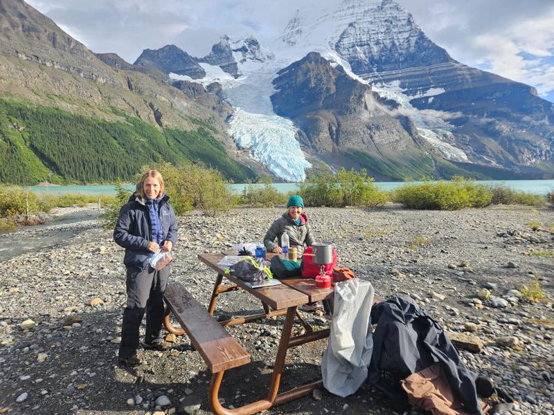
The Berg Lake trail is in Mount Robson Provincial Park – the closest town is Valemount. When we arrived, the weather didn’t look very favorable. There are campgrounds all along the 21km hike and our reservation for three nights was at the Berg Lake Campground, which is at kilometre 21. That would make it possible that on the nicest day of the forecast, we could do the 20km return hike from there to Snowbird Pass.
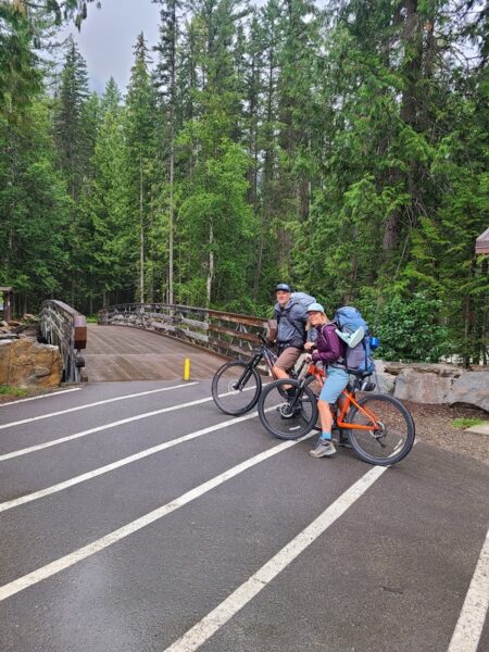
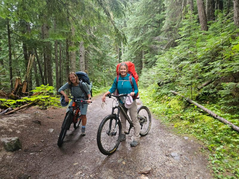
The 800-metre gain over the 21km to Berg Lake makes it a moderate to difficult hike. The first seven kilometres, we followed some online recommendations and rode our bikes. We questioned the wisdom of this decision riding uphill weighted with packs, but the forest, creeks and turquoise water of Kinney Lake distracted us from the discomfort.
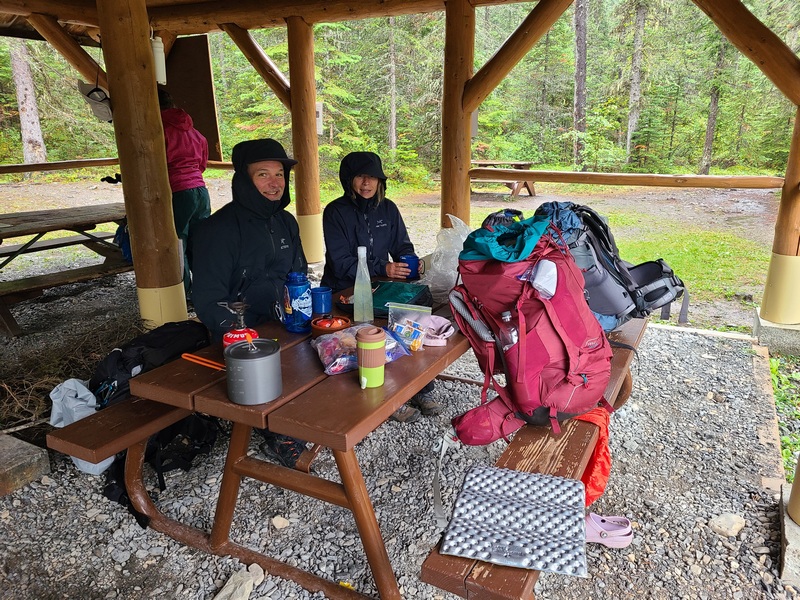
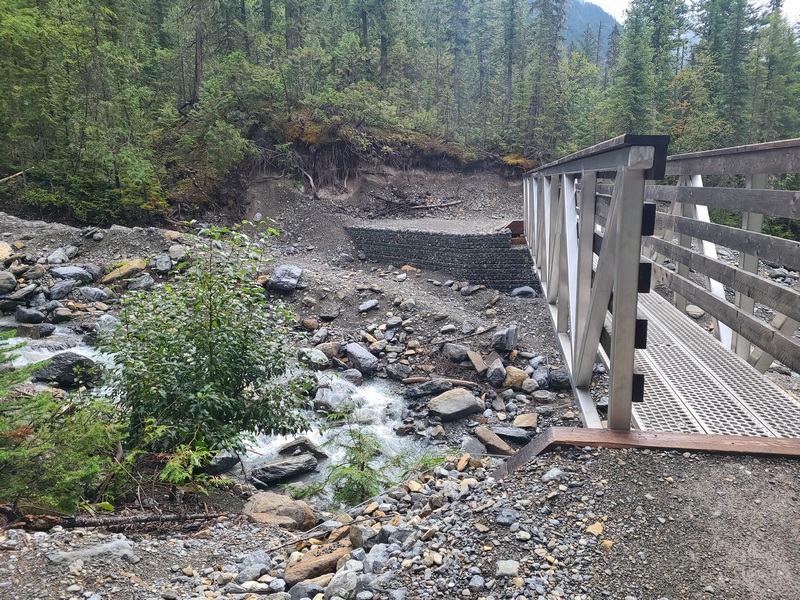
We locked our bikes up and started hiking. By kilometre ten, we heard thunder rolling past us followed by lightning flashes. We managed to reach one of the new park shelters before the rain started and I was glad to not have to cross a metal bridge during a thunderstorm.
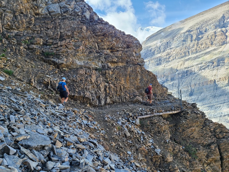
A major flood in July 2021 took out bridges and caused extensive damage to the Berg Lake trail. It was closed for rebuilding and completely reopened again in July 2025. You can still see the high-water mark in a couple places, and it was scary to imagine the torrent that caused the destruction. Sections of the trail have been completely rerouted to higher ground with brand new metal bridges at river crossings.
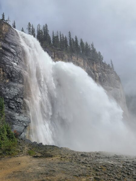
At the shelter, we watched the rain fall for about an hour after which we started our hike through the Valley of a Thousand Falls. This part reminded me a bit of Yosemite Park. We didn’t see a thousand falls, more like ten, culminating in Emperor Falls which could have been a thousand falls rolled into one. I don’t know if I’ve ever witnessed a larger force of nature in person. You could only walk so far into the spray before it felt like getting pounded with heavy rain. The sound was consuming, and I questioned how even the strongest rock wall could withstand that relentless pounding of water forever.
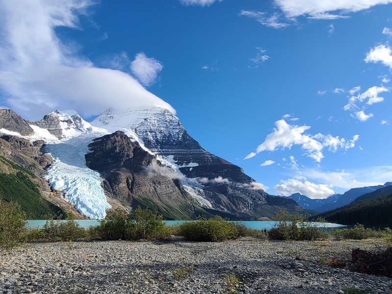
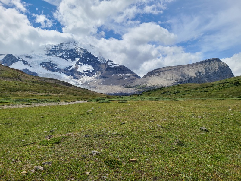
The Berg Lake campground sits facing Mount Robson. When you stand there looking at the mountain, it is hard to believe this is the tallest peak in the Canadian Rockies, until I realized the campground sits a hundred metres higher than the peak of my local ski hill, Mount Washington. Mount Robson is a very good-looking mountain, great for postcards. The First Nations called it, “The Mountain of the Spiral Road” because of its horizontal stripes – layers of limestone and shale. The mountain often has a soft tuft of flowing cloud attached to its peak, a bit of adornment called a lenticular or “cap cloud”.
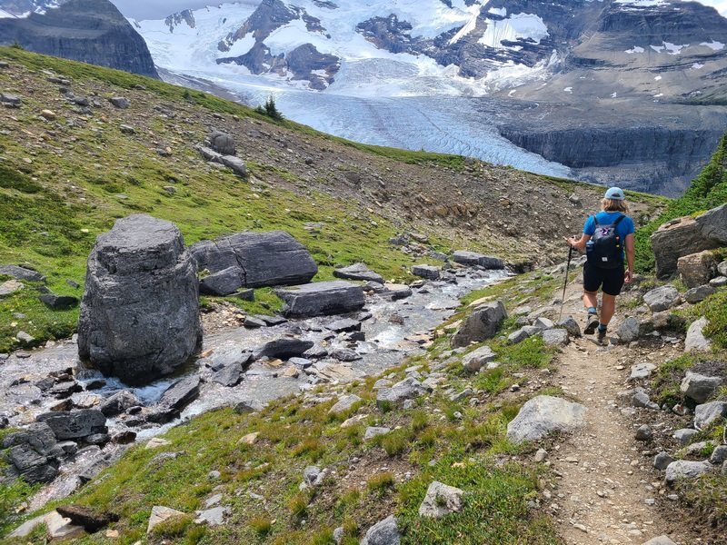
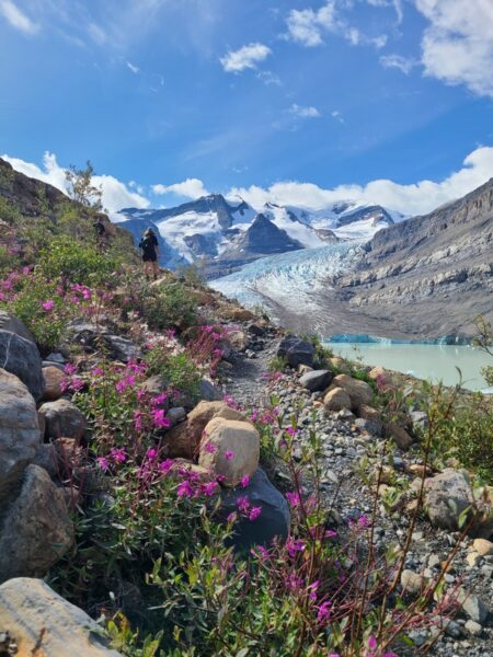
On our second day, we woke up to a pleasant mix of sun and cloud, perfect to hike to a place with a pretty name such as Snowbird Pass. Not wearing our heavy packs also contributed to the pleasantness. We walked through a valley to the other side of Mount Robson and in clear sight of Robson Glacier. Then we travelled up a steep cliff, (thankfully some brave mountaineers installed a fence with a chain railing), until we were on a plateau with a wide-open view. Here we hiked through meadows and along a cheerful bubbling crystal clear creek. There was a rise on one side of us and Mount Robson and Rearguard Mountain (named as it quietly sits at guard behind Mount Robson), overlooked us from behind.
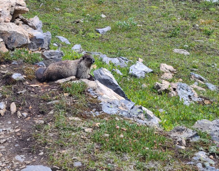
We heard a high-pitched sound, which we soon realized were marmots that greeted us along the way, or were probably threatening us, as other hikers had just seen marmot babies in that spot. Marmot babies! There was also a strange tiny white blob on a cliff wall in the near distance, which when we zoomed in on the photo we took, showed two mountain goats lounging on a rock.
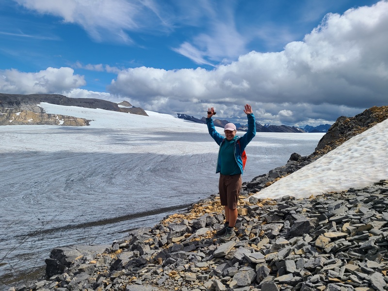
At the end of the plateau, we hiked up a short scree slope to Snowbird Pass which overlooks a large sea of white, the Reef Icefield. From here you can see far-off Rocky Mountains. This is the border to Jasper National Park, and we stood in Alberta for a moment.
Hiking back from Snowbird Pass, facing Mount Robson, along the clear bubbly creek, in the presence of marmots, twenty-two degree sunshine with puffy white clouds casting shadows on the meadow, it was hard to describe the feeling I felt. I was like a deep satisfaction in my gut. I wondered if the appreciation I felt for the idyllic weather and scenery, was somehow the same feeling humans may have had ever since we first walked the planet. I felt a connection to some deep history or past, or to a setting that humans may always have yearned for.
That evening there was another thunderstorm. We made the difficult decision that morning to hike back out a day early to avoid the upcoming forecast of “heavy rain”. At the end of the third consecutive day of hiking twenty kilometres, we glided the last seven kilometres downhill on our bikes along the raging Robson River. Now the online recommendations to bring bikes made sense.
Initially I was concerned that travelling from Vancouver Island would feel too far for a relatively short trip. However, I discovered that three days of non-stop hiking in a powerfully beautiful setting didn’t feel less rewarding than going on a longer trip. My friends and I felt the glow of accomplishment and bonding from experiencing together possibly the most spectacular trail any of us had even seen before.